Altavec offers powerful spatial information solutions designed to empower government agencies, educational institutions, and the public sector to enhance service delivery, urban planning, maintenance, and emergency response. With over 30 years of experience, we have become a trusted partner for governments, been providing cutting-edge tools to leverage the power of spatial data, enabling better decision-making and improved communities.
Through our extensive experience, we have gained in-depth knowledge of the unique challenges and opportunities faced by the government sector. Our products and solutions are tailored to address these specific needs, assisting in improving service delivery, reducing costs, and ensuring quick access to critical data during emergencies.
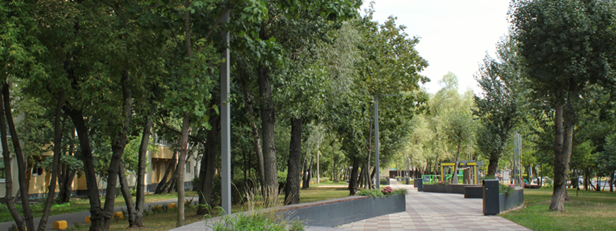
Altavec's solutions extend beyond emergency response to address ecological balance and urban planning. Altavec's high-resolution, classified 3D model of terrain and vegetation canopy is instrumental for Urban Tree Canopy off-set initiatives. Our vegetation management solutions are crucial for preserving the health and sustainability of ecosystems and urban spaces. We help address challenges posed by extreme weather events, contributing to improved air quality and creating more pleasant living environments.
Our comprehensive solutions cover a wide range of applications, from road maintenance planning and signage audits to rapid response during fires or floods. Our solutions ensure that all your stakeholders are empowered and accurately informed, enabling efficient emergency management. With the right data at hand, you can respond swiftly and effectively during emergencies.
We deliver high-resolution panoramic 3D imagery to government agencies, accessible through our cloud-based distribution and viewing tools. This enables easy access and seamless sharing of essential data, providing millimeter-perfect records of roads, signage, vegetation, and other infrastructure. We empower all stakeholders with accurate and up-to-date information, ensuring better decision-making and more informed actions. Our spatial solutions play a crucial role in improving service delivery and reducing operational costs for government agencies.
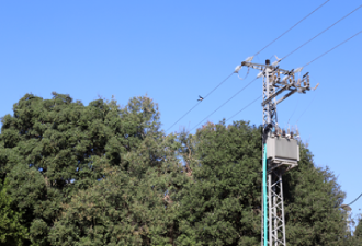
Our ground and aerial vehicle-mounted capture systems incorporate a wide array of advanced technologies, including LiDAR scanners, GPS, high-resolution cameras, weather sensors, 4K video, and thermal infrared. This ensures a complete and detailed picture of your community and its assets, facilitating effective planning and management.
We understand that data becomes truly valuable when it can drive informed decisions. Our solutions utilise machine learning, robotics, and powerful analysis. We automatically analyse spatial data, identifying assets, infrastructure, defects, or degradation, and predicting potential failures before they occur. This capability reduces costs, enhances community safety, prevents downtime, and keeps everything moving smoothly.
Navigating the complexities of communities, assets, and infrastructure is made easier with our cloud-based solutions. Our powerful yet intuitive tools grant you seamless access to critical information whenever and wherever you need it. By transforming detailed spatial data and imagery into precise digital twins, coupled with robust tracking and compliance reporting capabilities, Altavec empowers you to make strategic decisions, efficiently manage compliance, and streamline maintenance processes.
With Altavec's advanced spatial solutions, government agencies can harness the power of spatial information to drive efficiency, safety, and informed decision-making. Our cutting-edge technologies enable you to take a proactive approach to service delivery, emergency response, and environmental preservation, leading to better communities and a more sustainable future.
Discover comprehensive end-to-end solutions addressing extreme weather challenges, wildfire prevention, and sustainable urban spaces.
Leverage our expertise in Lidar capture, panoramic imagery, and spatial analysis to maximise the value of your digital assets and drive sustainable innovation.

Democratise your Spatial Data and Visualize Assets. Altavec’s Digital Model will enhance collaboration across your organisation with cutting-edge analytics and simulation tools.
Get in touch wth our dedicated team of experts today and experience the Altavec Advantage