In a dynamic business landscape, the increasing use of spatial data is transforming traditional asset management and operational practices. However, many organisations encounter challenges in effectively managing and optimising the wealth of spatial data they capture. Altavec's Spatial Services solution addresses these challenges head-on, offering a comprehensive suite of cutting-edge solutions tailored to meet diverse geospatial needs.
Altavec's Spatial Services leverage advanced Lidar capture, panoramic imagery, and spatial analysis to extract actionable insights. These insights enhance the effectiveness and efficiency of traditional design, asset assessment, and maintenance programs, driving greater value from spatial data investments.
With a focus on cutting-edge technology and data-driven insights, Altavec positions itself as a crucial partner in solving challenges faced by various sectors. By offering innovative spatial solutions, Altavec empowers industries to optimize their operations, make informed decisions, and drive sustainable growth.
Altavec's spatial offerings cater to diverse requirements, ensuring that each solution is tailored to specific geospatial needs. From Lidar capture to panoramic imagery and spatial analysis, Altavec's expertise covers a wide spectrum of geospatial services.
Altavec's Spatial Services empower organizations to streamline traditional design, asset assessment, and maintenance programs. By leveraging advanced technologies, businesses can achieve higher accuracy, greater efficiency, and more effective management of their assets.
Altavec's Spatial Services empower organizations to streamline traditional design, asset assessment, and maintenance programs. By leveraging advanced technologies, businesses can achieve higher accuracy, greater efficiency, and more effective management of their assets.
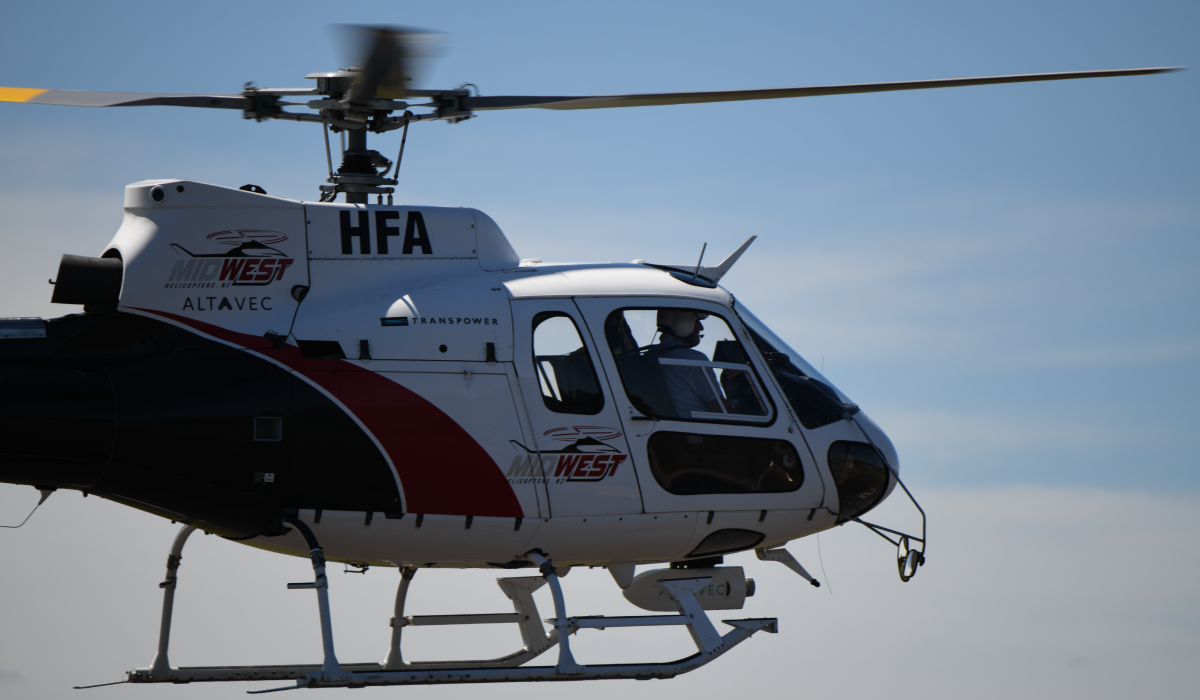
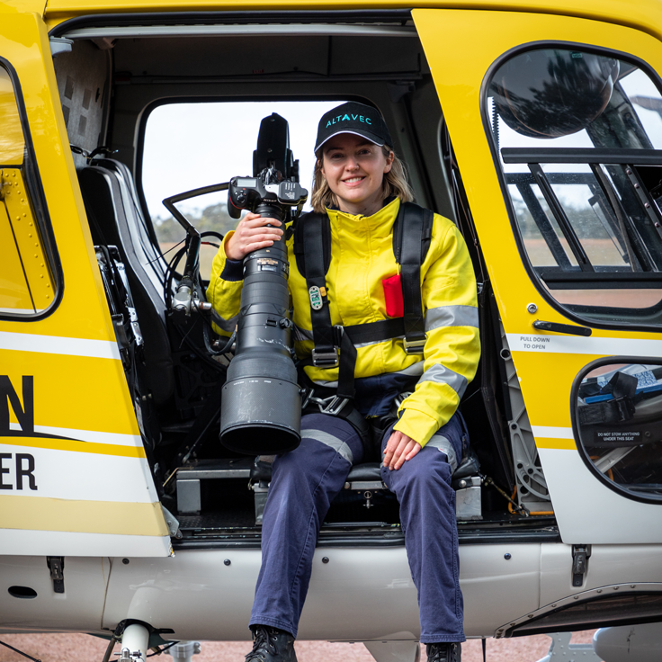
Altavec sets a new standard in asset information capture by seamlessly combining high-resolution image capture, panoramic image capture, and LiDAR data in a single pass. This unique capability allows for a comprehensive and holistic approach to data collection, providing an unparalleled level of detail and accuracy in a single operation. With its advanced technology, Altavec's integrated system captures ultra-high-resolution images that even capture the finest asset details, ensuring precise visual documentation.
Panoramic image capture provides a wide-field view, allowing for contextual information and a broader understanding of the asset's surroundings. To top it off, LiDAR data complements the imagery with its ability to accurately measure distances and capture three-dimensional information, enabling precise asset modeling and analysis. This amalgamation of high-resolution imagery, panoramic views, and LiDAR data enhances efficiency, reduces data collection time, and empowers industries across sectors to make informed decisions based on comprehensive and multidimensional asset information.
Altavec's LiDAR capture capability is a cutting-edge technology that revolutionizes asset information capture with its versatile range of scanners. By employing LiDAR (Light Detection and Ranging) technology, Altavec can capture highly accurate and detailed data from various perspectives. Its range of scanners includes aerial, car, train, and drone options, each offering unique advantages for capturing asset information safely and cost-effectively.
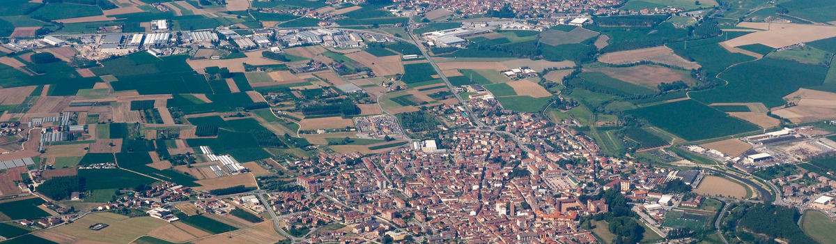
Our high-resolution imagery capture for assets by employing a versatile array of platforms, including aerial, drones, rail, and car-based systems. Through aerial capture, Altavec utilizes advanced aircraft equipped with state-of-the-art cameras to acquire exceptionally detailed images from elevated perspectives. This method proves invaluable for surveying extensive areas and large-scale assets. For more localized and challenging environments, Altavec deploys drones equipped with high-resolution cameras, offering unparalleled flexibility and accessibility. These agile drones navigate through complex terrains, confined spaces, and hazardous sites, capturing intricate asset details with utmost precision.
Additionally, Altavec leverages rail-mounted and car-based high-resolution imaging systems for ground-level data collection, enabling comprehensive documentation of assets in urban settings and along linear infrastructure. By leveraging a diverse set of capture options, Altavec ensures that industries receive comprehensive and accurate visual data, empowering them to make informed decisions, perform detailed asset inspections, and optimize asset management strategies.
Altavec sets the standard for panoramic image capture with its state-of-the-art train-mounted and vehicle-based systems. These cutting-edge platforms offer a wide-field view that provides a comprehensive visual perspective of the surrounding environment and assets.
When mounted on trains, Altavec's panoramic image capture system enables efficient data collection along railway corridors and other linear infrastructure. As the train moves along the tracks, the system captures continuous panoramic images, ensuring a seamless and detailed representation of the entire route. This approach is particularly beneficial for monitoring tracks, bridges, and other critical assets in a single pass, reducing the need for multiple surveys and enhancing operational efficiency.
Similarly, on vehicle-based systems, Altavec captures panoramic images while navigating through urban areas, highways, and industrial sites. This capability offers a holistic view of the assets, facilitating effective asset management and decision-making processes. By utilizing these panoramic image capture capabilities on trains and vehicles, Altavec equips industries with a comprehensive visual understanding of their assets, empowering them to enhance safety, maintenance, and overall asset performance.
Don't wait for issues to arise—be in control of your assets with Altavec's innovative Spatial & Capture Services Solutions. Our advanced technologies empower you to make proactive decisions, minimize downtime, and optimize long-term asset value. Embrace the safety and accuracy of aerial inspections with high-resolution cameras on drones, eliminating the need for personnel to access hazardous areas physically. With streamlined data management efforts, enjoy seamless workflows and efficient asset management processes.
Maximize asset performance, increase reliability, and ensure regulatory compliance with Altavec's cutting-edge solution. Elevate your asset management practices and stay ahead in the competitive landscape. Contact us today for a personalised demonstration and discover how Altavec can revolutionise your asset management journey. Together, let's shape a smarter, safer, and more sustainable future for your assets.
Get in touch wth our dedicated team of experts today and experience the Altavec Advantage