Altavec carries out a laser clearance survey for bi-level trains feasibility, on behalf of SEPTA, Philadelphia
Located 75 km south west of Melbourne, Geelong is Victoria’s largest provincial centre and its fastest growing region.
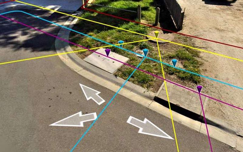
The City of Greater Geelong had a legal requirement to record an inventory of road signs to comply with the Road Management Act. The city contains 2000 km of urban and rural roads with an additional 500 km of VicRoads arterial roads in the municipality.
Council had also adopted a street tree strategy to increase the presence of street trees in the region and create a maintenance regime for the existing plantings. To manage street trees an inventory of Geelong’s tens of thousands of street trees was needed. Collecting information on both these asset types by traditional survey methods was considered prohibitively expensive and an alternative approach was needed.
Altavec (formerly Geomatic Technologies) provided a complete end-to-end solution, collecting and hosting 3D street level imagery, as well as delivering an application development platform and spatially accurate results within Council’s Geographic Information System (GIS) and Asset Management System (Hansen).
An inventory of road signs and trees was then created by using an automated technique which could differentiate and record attributes of each sign and tree, thus saving on significant manual efforts.
Altavec carries out a laser clearance survey for bi-level trains feasibility, on behalf of SEPTA, Philadelphia
"The investment we made will pay dividends for years to come. They not only met their obligations, but exceeded our expectations"
Altavec Capturing and Mapping signage and trees for the City of Greater Geelong
Get in touch wth our dedicated team of experts today and experience the Altavec Advantage